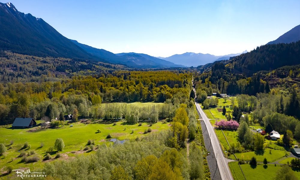
Make Darrington Your One Tank Get Away!
Driving Here –
Driving from the Seattle area to Darrington is about a 90 minute to a 2 hour drive depending on your starting point. Drive north on I-5, take the exit #230 turning east on SR 530 to Arlington, Oso and Darrington. You reach Darrington after driving approximately one and half hours.
Driving from the Bellingham area to Darrington is about a one and half hours taking I-5 and about a two hour drive taking Highway #9, depending on your starting point. Drive south on I-5, take the exit #230 turning east on SR 530 to Arlington, Oso and Darrington. Taking Highway #9, the highway travels through Arlington, turn east on SR 530.
Transportation-
The Community Transit Route #230 comes up SR 530 all the way from Everett-Smokey Point to Darrington. The route travels through Arlington where some transfer options are available. See website for Community Transit. The buses are also equipped to bring your bicycle with you. The Stop #514, Lake Cavanaugh Road and Stop #528, Whitman Road are easy access to the Whitehorse Trail. See list of transit stops.
DCDirect provides transportation to Concrete and Skagit County. This shuttle is provided by the Sauk-Suiattle Tribe. Fare information: Sauk-Suiattle Reservation to Darrington – $0.50, Darrington to Concrete – $1.00, local in Darrington – Free, local in Concrete – Free, Students, Seniors & Disabled – Free. “We envision a transportation system in Skagit & Stillaguamish Valleys providing mobility for our entire communities. Children & youth, older adults, people of disabilities & those with low incomes will share in a coordinated system designed to gain economies of scale, eliminate duplication & expand service availability & quality”. See their schedule
Other ways to come to Darrington –
Fly your plane in to the Darrington Municipal Airport and take in the legendary views! What makes our airport so unique is you can fly your smaller plane right into town with an easy walking distance to shopping and dining. So welcome to Darrington and make a day of it! See AirNav – Darrington Municipal Airport
Drive the beautiful and historical Mountain Loop Highway. This road, a rustic scenic byway, in itself is a destination winding through forest, mountains, rivers, waterfalls and more! From Granite Falls drive east to Mountain Loop Hwy. for 18 miles toward Barlow Pass. From beyond Barlow Pass this road will become gravel and the adventure begins. As you continue your 14 mile drive on gravel you will pass the trailhead to the historical mining town of Monte Cristo. After driving 14 miles the road again is paved. After driving another 6 miles you will reach the town of Darrington. Learn more about the Mountain Loop Highway.
Discover the Whitehorse Trail! Snohomish County continues work to construct a trail following the historical 27 mile railroad grade of the old Arlington-Darrington Line. Parts of this trail are now open with several newly re-decked bridge crossings offering nice vistas. The trail also travels along four old millponds, great for birding. You can enjoy this trail by horseback, bicycle or walking. Someday this trail will connect to the Centennial Trail west of Arlington all the way to Darrington! Learn more about the Whitehorse Regional Trail.