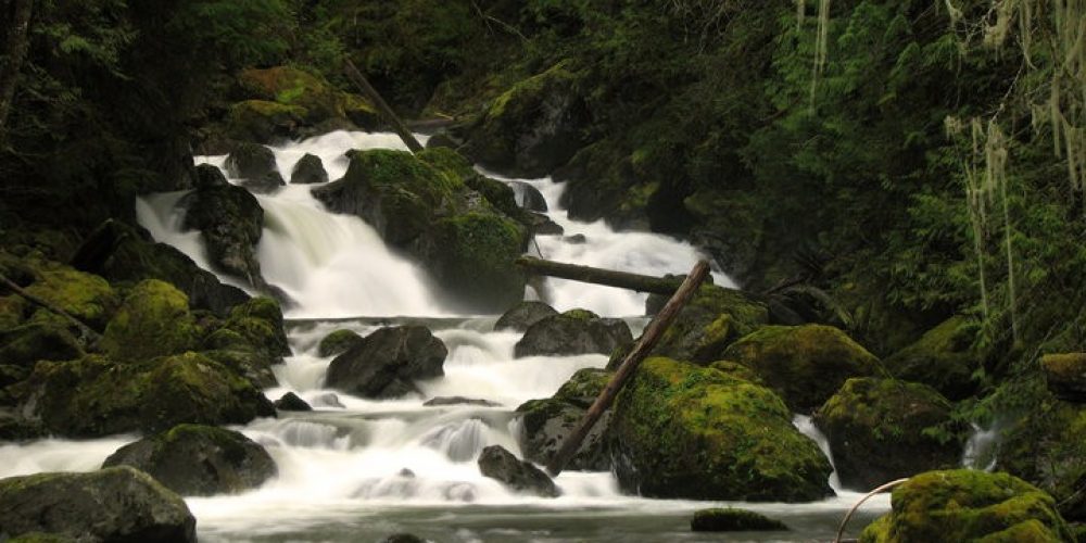
Boulder River Trail #734
Boulder River Trail is often referred to as Boulder Falls Trail because of the impressive falls along the trail. The official Boulder Falls is on the Boulder River and is not seen from the trail, however once starting on your hike you will actually hear it in the distance thundering far below as it makes a 40 foot drop. This pleasant relaxing hike starts on the old Railroad grade constructed by Standard Railway and Timber Company back in 1907. Look for the signs of the old railroad as you hike.
As it parallels Boulder River, the trail takes you through old growth forest crossing several streams & creeks. This trail was once the route to the famous Three Fingers Fire Lookout, but now only 4 miles of the trail remain. At a little over 1 mile you will come to your first waterfall, Pre-Show Falls. Pre-Show Falls is a delicate waterfall with not much volume of flow although it is active year round. The waterfall laces its way through maidenhair ferns & moss dropping a total of 150 feet down a steep rocky face.
Views from Boulder River Trail
As you continue your hike you will come to the second waterfall known as Feature Show Falls. This is one of the most famous waterfalls of the North Cascade Mountains. Feature Show Falls is on the opposite side of the river. The waterfall drops 260 feet down a rock face splitting into two main segments. A bench is provided along the trail so you can rest and admire the magic motions of water over rock.
Departing Feature Show Falls and hiking further, the trail gradually climbs away from the river and takes you deeper into the forest. Continuing, you will come to an old downed bridge that you will have to pick your way across. As you begin your descent at about 2 miles you will come to the third waterfall, Meditation Falls. Meditation Falls plunges 60 feet along a rock face and forms a mesmerizing “V” in the center of it. A short distance after this point the trail reaches Boulder River and the end of the trail. Boulder River Trail is a low elevation all season hike starting out at only 1,000 feet. Any time of the year is a fine time to view this trio of waterfalls & see the river as it changes season by season. Prolonged cold winter weather turns the Boulder River into a magical place of long icicles and freezing waterfalls.
Getting there:
From the Darrington District Ranger Station drive SR 530 west for 8.2 miles, near milepost 41, turn left, (south) onto French Creek Road, Forest Road #2010, drive 3.7 miles to the trailhead. Note that at 1 mile you will come to the vault toilet, there is no toilet at the trailhead.
History: Trail follows old Hazel Logging Railroad
Wilderness restrictions: Yes, trail enters Boulder River Wilderness
Type of trail: USFS
Length: 4miles
Elevation: 1,000 – 1,400
Level of difficulty: easy
Best seasons: Summer & Fall
Wilderness restrictions: No
Northwest Trail Pass required
Restroom: Vault toilet 1 mile as you turn off SR 530 onto Forest Road #2010
