Pacific Crest Trail – Darrington Ranger District
The Pacific Crest National Scenic Trail stretches over 2,650 miles from Mexico to Canada. It winds through chaparral hillsides and scorching bits of desert in Southern California. The trail traverses the high passes of the Sierra Nevada, then marches along the ridges of the Cascade Mountain’s statovolcanoes on its way to the Canadian border. It is breathtaking along its entire route and its vastness challenges the imagination of all hikers and equestrians who step foot on its dirt tread. However, it can reasonable be argued that in the Glacier Peak Wilderness, the Pacific Crest Trail, PCT, exemplifies truest expression of a mountain footpath and is one of the most remote and stunning sections of the trail. It is also one of the most arduous, climbing in and out of three river drainages.
Near Darrington, the trail can be accessed by hiking up one of two old growth valleys. From the Mountain Loop Highway, one can take Forest Road #49, Sloan Creek Road, to reach the North Fork Sauk Trail, then proceed 8.4 miles up the valley until the junction with the PCT in the stunning area between White Pass and Red Pass. One can also access the PCT via Bald Eagle Trailhead by continuing past the North Sauk Trailhead 6.5 miles, .5 miles past the stock unload, where the trailhead is, traversing over Curry Gap. Beginning from White Pass, the trail traverses through alpine meadows to Red Pass, then descends into Glacier Peak Meadows and on to the old growth forest of the White Chuck River Drainage.
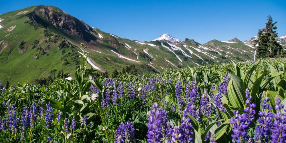
Views From The Darrington Ranger District PCT
The trail crosses the White Chuck River and continues to loose elevation toward Kennedy Creek. After crossing the sometimes difficult and usually bridge free Kennedy Creek, the trail begins to ascent up to Milk Creek Pass at 6,300 feet. Enjoy the views as the trail begins another elevation drop into Milk Creek Valley at 3,500 feet. From Milk Creek crossing the trail begins the brushy and often damp switchbacks up to East Fork Basin at approximately 5,300 feet. From here the trail continues climbing through the basin arriving at Vista Ridge. Wildflowers and mountain views are in abundance. From here the trail begins another long descent into the Suiattle Valley.
One can also access the PCT, 38 trail miles north along the Suiattle River over Suiattle Pass at 5,900 feet elevation. There are several side trails off the PCT and certainly worthy destinations in their own right. The names alone conjure urges; Miners Ridge, Gamma Ridge, Pilot Ridge and others. The wilderness villages of Stehekin and Holden are popular stopping points for the through hikers as well as a destination for a personal retreat. This route was previously closed for 11 years after massive floods washed out the Suiattle River Road in 2003. Thanks to collaborative efforts from state, local and tribal governments, this important entry point to the backcountry is once again open. Hikers can now travel south on the PCT over Vista Ridge to reach the base of Glacier Peak and it’s sparkling jewel, Mica Lake, or head north and reach the famous Mirror Lake. However you reach it, the Glacier Peak Wilderness is not to be missed!
For more detailed information on the PCT and ongoing trail projects and conditions in the Darrington area, contact the Darrington Ranger Station. For extended information on the PCT, contact the Pacific Crest Trail Association.