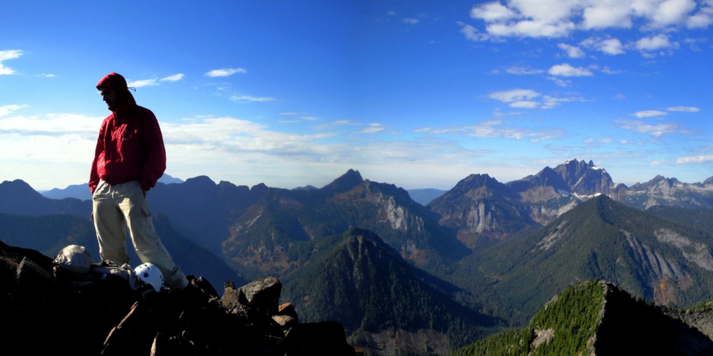
Helena Ridge Trail
The Helena Ridge Trail begins approximately 6 1/2 miles from the Mountain Loop Highway. This rugged seldom hiked trail traverses up to Helena Ridge and accesses the climbing route to Iron Mountain.
The trail starts off gradually following an abandoned logging road to a second logging landing where it departs the road and becomes a forest trail. At this point it starts a steep ascent in the direction of the ridge top where it intersects with the original trail built between 1933 and 1936.
The trail is marked with fading tree blazes and follows through old growth forest south along the ridge up to where a climbers trail heads on toward the traverse to Iron Mountain which rises to 4580 ft. elevation. The main trail then descends several hundred feet, passing through meadows and rocky areas with spectacular views in all directions.
Helena Lake and seasonal Jade Falls come into view at about 5 1/2 miles with Devils Thumb and Devils Peak in the background. This is about half way along the trail and very close to where another old trail shelter used to stand in a beautiful meadow.
The trail climbs back up several hundred feet to the ridge top and continues south through more old growth forest for several miles before turning slightly west high above Windom Lake and working it’s way along a steep hillside to connect with the North Lake trail near a small tarn. This was the location of another trail shelter long ago. The North Lake trail descends through a series of switchbacks to Independence Lake and then out to the trailhead at the end of the Coal Lake Road to conclude an approximate 12 mile hike.
Views From Helena Ridge & Summit
When hiking the backcountry and especially when on user trails be sure you notify someone of your itinerary. Be prepared for unpredictable weather conditions and be aware that it is easy to get turned around or disorientated. Make room in your pack for the essentials of survival, which should include at a minimum, maps, a compass, food and extra clothes. Written by Richard Morell, Friends For Public Use, Forest Road Adopter for the Helena Ridge Roads
Getting there: From Darrington drive south on the Mountain Loop Highway for almost 9 miles, turn right (west) on Forest Road #2070. Drive up about 2.5 miles, keep to the right taking Forest Road #2075. After passing a rock pit and old gate the trail and old road can be seen on the left.
History: This trail was once a Forest Service trail that was abandoned now only maintained by very dedicated volunteers, both keeping the trail cleared and through a Friends For Public Use volunteer road adoption keeping the road to the trailhead cleared and accessible as well.
Type of trail: User built trail from abandoned Forest Service Trail
Length: No determined length being this is a user trail branching in several directions. There is no maintenance nor accurate mapping of these trails.
Elevation: undetermined, trail starts at about 3,000 feet – ridge summit is about 4,600 feet
Level of difficulty: most difficult
Best seasons: Summer & Fall
Wilderness restrictions: None. These user trail descriptions are not within wilderness boundaries although other connecting trails could access wilderness areas.
Northwest Trail Pass required, No
Restroom: No
