Gold Hill Scenic Loop Drive
Gold Hill or Gold Mountain? If you look for it on the map you will see Gold Mountain. Gold Hill is a name fondly given to this special mountain by local community for generations. Though it is a mountain in its own right with respectable elevation of 3,400 feet, it is dwarfed by the other mountains surrounding Darrington. Whitehorse Mountain towers over the town at an elevation of 6,852 feet and the neighboring Jumbo Mountain at 5,581 feet. Gold Hill is a great destination for scenic views of the surrounding mountains and the valleys below. Gold Hill is also a place rich in local history. So lets take a scenic backroad drive over Gold Hill.
While driving try to imagine that between 1895 and 1900 there were over 100 mining claims on this small mountain. These were the days of the Monte Cristo Gold Rush. Darrington was having its own gold rush too back at this time. It was said that there was so much dynamite blasting around the fledgling town it was enough to give you the jitters! There are still mining tunnels on Gold Hill from bygone days and there are still some active claims too. Please respect where prospecting claims are posted.
To start your drive, drive about 9 miles from Darrington on the Mountain Loop Highway, take a left over the White Chuck River Bridge to the left. This puts you on Forest Service Road #22, continue driving about 3 miles, you will pass a road to the left dropping down hill which is the road to Cougar Hollow, keep to the right going up hill. This stretch of road has Dwarf Woodland Rose, Turks Cap and Red Columbine in bloom.
As you are driving on Forest Service Road #24 see if you can spot the subtle grades the Sauk River Logging Railroad left behind. At mile 1.7 look to the left. Can you see the old railroad grade? When you reach 1.9 miles you will see water seeping out of the rocks on the right. This is Sweet Water, water from a spring flowing out of limestone. At one time there was a mining claim here for lime rock.
As you continue driving higher up, you will see Forest Service Road # 2420 to the left. You can take this rougher road back making this drive a loop or continue going on Forest Service Road #24 on to Sauk Prairie then back to town. Continuing on FSR #24, there are some nice seasonal small waterfalls and cascades along the way.
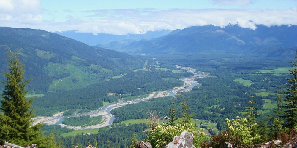
Continuing about 3 miles views of the Sauk River Valley open up, a name to remind us of the first people to call this valley their home. As you look down the valley imagine the Sauk-Suiattle Tribal people skillfully navigating these swift waters with their dug out canoes.
There were two fire lookouts on Gold hill, the Dans Creek lookout was lower lookout built in 1940 looking over the valley pretty much as you are seeing it here. There was also the Gold Mountain Lookout built in 1915, the first lookout built in the Northwest.
From this point in your drive you descends down to the valley below. Once reaching the valley, you can make a right and explore the beautiful Sauk Valley, or make a left heading back toward Darrington and SR 530.
