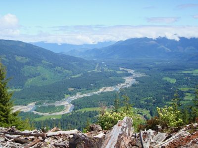
At one time the distant glows of the lamps lit by the lookout shown at night on nearly every major peak in the Darrington area. Today only four fire lookouts are still standing in the Darrington Ranger District, but the legacy of the era of the fire lookout still remains. Several hiking hiking trails will take you to the places where once the dedicated lookout man or woman once spent weeks of solitude watching over the forest seeing for miles from their mountaintop aerie.
Bannock Mountain Fire Lookout
Built 1930 – Abandoned Date unknown
Bannock Mountain Fire Lookout was built in the 1930s. It was later abandoned, date not recorded. This very remote lookout was located 11 miles northeast of Glacier Peak and was at an elevation of 7,484 feet atop Bannock Mountain.
Barlow Point Fire Lookout
Built 1935 – Destroyed 1964
Barlow Point “Pass” Fire Lookout was built in 1935 and had a L 4 cab. The lookout was destroyed in 1964. This lookout was located at Barlow Pass on the Mountain Loop Highway, elevation 3, 222 feet. Today you can hike Barlow Point Trail #709 where the lookout use to be to get some great views of the Sauk and Stillaguamish River Valleys and surrounding mountains.
Blackjack Ridge Fire Lookout
Built 1935 – Abandoned 1950
Blackjack Ridge Fire Lookout was built in 1935 as a 30 foot pole L-4 tower, (circa) 1945 a shake cabin was added to the site. It was abandoned in 1950. The lookout was located 16 miles east of Granite Falls on Blackjack Ridge at an elevation of 4,285 feet.
Circle Peak Fire Lookout
Built 1933 – Destroyed 1967
Circle Peak Fire Lookout started out as a camp in 1929. In 1933 a 14 by 14 foot framed cab was constructed, this type of construction was referred to as a “Grange Hall” construction. The lookout was later destroyed in 1967. This lookout was 13 miles east of Darrington on Circle Peak slightly on the west slope, elevation 5,983 feet. Today you can hike the Circle Peak Trail #638.1 to this lookout site
Dans Creek Fire Lookout
Built 1940 – Abandoned 1944
Dans Creek Fire Lookout was built in 1940 and was located on the northwest slope of Gold Hill East of Darrington, The lookout was situated on upstream of Dans Creek on along the eastern bench at an elevation of 1,940 feet. This lower elevation lookout was able to see clearly under cloud cover to the mountains and valley to the north. The cabin was “manned” part time and worked in conjunction with the Gold hill Ranger Station located on Sauk Prairie to the west. The lookout was abandoned in 1944, however volunteers operated the lookout during bad fire seasons. The cabin was reported as still standing in the 1980’s. Ruins or cabin could not be located in 2011.
Darrington Fire Lookout
Built 1932 – Abandoned sometime in the 1940s
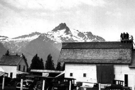
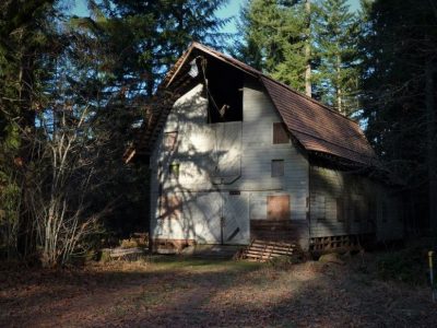
At one time the Darrington Ranger District Livery Barn, constructed in 1916, had a fire lookout tower built on top of the roof back in 1932. This was primarily used for training future “lookouts” to use the fire finder during Fire Lookout School. It is unclear when the tower was removed, but it was some time in the 1940s.
This old historical barn still stands today on the north end of Darrington at the Darrington Ranger Station. For a long time its future looked pretty bleak. Funds were secured through grants to fix the failing roof and work parties were held to give it a good cleaning, restoring the wood plank floor using wooden nails and a lot more! Today you can see this grand old barn from the Whitehorse Trail starting from town.
Finney Peak Fire Lookout
Built 1935 – Abandoned 1965
Finney Peak Fire Lookout was built in 1933 and had an L-4 cab. Later it was abandoned in 1965. This lookout was located 10 miles northwest of Darrington right on Finney Peak, elevation 5,854 feet. For many years there was a trail to this old lookout site, when the road became inaccessible the trail grew over and faded away.
French Point Lookout
Built 1935 – Abandoned 1959
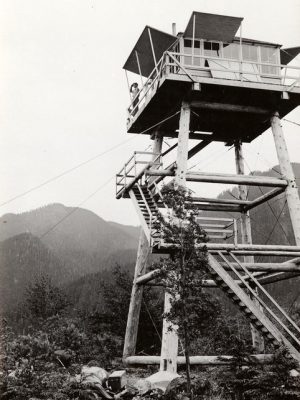
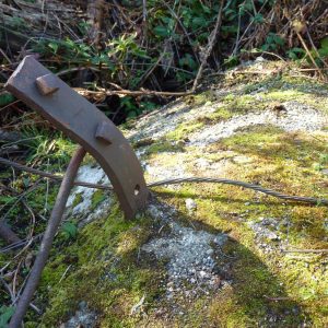
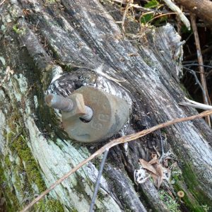
French Point Fire Lookout was built in 1935 and had a 35 foot pole tower with an L-4 cab. The lookout was abandoned in 1959. Sometime before 1970 the lookout was knocked down or fell down over time. The ruins of the lookout still remain on site.
This lookout was located 8 miles west of Darrington, near the French Creek Road, Forest Service Road #2010, about half way up to the Boulder River Trailhead on the west side where there is a road going up hill.
The lookout was built at a low elevation 1,400 feet. The Three Fingers Fire Lookout was south of this lookout at an elevation of 6,854 feet with far reaching views but couldn’t see the NF Stillaguamish Valley below high cloud cover, so they built the French Point Fire Lookout to cover these blind spots.
A road was built up to the lookout site in 1934, one year prior to its construction. Around 1975 this road was altered changing the westward curve and straightening the road, however still goes adjacent to the site. The four poles for the tower lay northeast in a thicket of blackberries and new growth trees. They would appear to be just random logs with the exception that they lay all at the same angle and are embedded with the old hardware.
