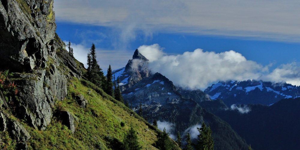
Mount Pugh Trail #644
Starting this hike, be aware that forest service history is looming high above you. The first mile and a half is in cool mature forest, sometimes switchbacking upward and at other times crossing a series of small streams cascading down the hillside. Views are limited here but improve as the trail passes 3.4 acre Lake Metan at elevation 2,800 feet. There is a spring prior to reaching the lake which is your last water source along the trail. The trail then continues with long gradual switchbacks ascending to a small meadow at 3.5 miles. Mountain goats can frequently be seen on the upper slopes of the drainage. Still walking in the forest the trail begins to steepen.
An impressive grouping of boulders replace the trees and soon Stujack Pass is visible. Rest here amidst the last few trees and rocks before making the final push to the pass, keeping your hopes high for hitting the early wildflower season. Even into fall there is an abundance of Western Wild Ginger and various Indian Pipes growing along the trail. The switchbacks provide better and better views as you ascend to Stujack Pass at about 5,700 feet elevation. White Chuck Mountain is right in front of you. Shade can be found here, use it to soak in the views and let your body rest a bit.
A trail continues to the summit of Mt. Pugh, though some prefer to call Stujack Pass their destination. The trail to the summit is more of a scramble although it is clearly defined. Notice some historic relics from this point on. Perceptive hikers may spot the remains of an old tram or notice that blasting has occurred to improve the trail. Mount Pugh is the mass between the Sauk River and the White Chuck River and that becomes obvious here, high above both valleys.
The renowned knife edge has turned back some cautious hikers, but beyond it there is a challenging but non-technical climb to the summit. Hands may be needed to scramble upward but the apex ahead is most rewarding. At the summit, especially if it is clear, you will see the superb giant ex-volcano, Glacier Peak. The entire chain of regional peaks reachable from the Mountain Loop Hwy. area can be identified from the summit. The peaks of Monte Cristo and White Chuck are closest and further out are the other Washington notables, Mount Rainier, Mount Baker and the Olympic Range.
The history of the Mount Pugh fire lookout started in 1916, when a “Rag House” camp tent was erected containing an Alidade firefinder. Legendary Nels Bruseth served as the first lookout man. In 1919 a cabin was built and used until it was destroyed by lightning. It was rebuilt in 1927. In 1965 the lookout was destroyed and never rebuilt.
Views From Mount Pugh Trail
Written by Rudy Gieck
Getting there: From the Darrington Ranger Station, drive the Mountain Loop Highway 14.0 miles to FS road #2095 on the left. Proceed for 1.0 mile. The trailhead is on your right and should be signed. Northwest Forest Pass required per parked vehicle.
History: Follows the old route to the Mount Pugh Fire Lookout site.
Type of trail: USFS
Length: 4.5 miles one way to Stujack Pass and 5.5 miles to the Mount Pugh summit
Elevation: 1,900 – 5,300
Level of difficulty: most difficult
Best seasons: Summer & Fall
Wilderness restrictions: Yes, enters the Glacier Peak Wilderness
Northwest Trail Pass required
Restroom: No
For more information:
