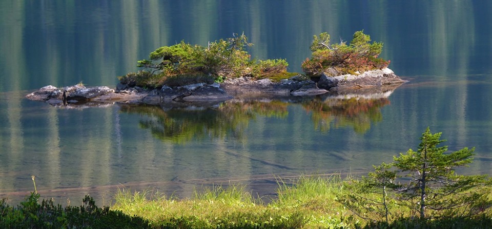
Crystal Lake Trail #638
There are two routes to Crystal Lake
A Forest Service Trailhead is located at the barricaded Meadow Mountain forest road, #2710. At 1.5 miles you will come to a junction with Meadow Mountain trail #657 straight ahead and Crystal Lake trail #638 to the left. Take the left trail which continues up another deteriorating and neglected forest road that can be quite brushy. At 2 miles you will come to the end of the old road where the trail begins a steep ascent up an aged firebreak.
Although this is a very steep uphill scramble take time to relax and view Crystal Creek Falls as it drops about 40 feet down a rock embankment. After about .5 miles the firebreak levels off and becomes a trail with mature forest as it enters the Glacier Peak Wilderness. Ironically once you reach the lake, you will come to the forest service built trail crossing the outlet, with large stepping stones. It continues uphill and joins Circle Peak Trail #638.1. This trail Follows it’s namesake creek and soon begins aSpending steep switchbacks until one reaches majestic Circle Peak where once stood a fire lookout.
If entering from Circle Creek Road, Forest Road #2703, there is a user cutoff trail at the junction of the Circle Peak and the Crystal Lake Trails. To reach Crystal Lake head to the right toward Skaar Pass. This is a Forest Service built trail, which has not been maintained for many years due to road inaccessibility. Thanks to the devotion of three volunteer road clearing groups, RRT, DARA and FFPU, this road was able to be reopened. Hiking the Skaar Pass route is about 3 miles. A campsite is located close to the lake just before the outflow. Large professionally laid stones make the crossing easy here.
There are several camp spots nestled in the trees and across the creek drainage. Please camp in established sites. Beautiful Crystal Lake is about 20 acres in size and can be explored on several footpaths. The banks of the lake are carpeted with heather and other wildflowers. There is one wilderness toilet adjacent to the southeast shore but the signage has seen better days.
Views from Crystal Lake Trail
Getting there:
Suiattle Route – From the Darrington Ranger Station, drive SR 530 north for 7 miles to the Suiattle River Road, FSR #26, drive for about 10 miles to the Boundary bridge on the right, this is Forest Road #25, drive 3.5 miles to Rat Trap Pass Road, FSR #27 and drive 7 miles to the Meadow Mountain – Crystal Lake Trailhead.
- To take the Circle Creek Road to the cutoff on the trails, drive 3.2 miles on Rat Trap Pass Road, turn left on Circle Creek Road, FSR #2703, drive about 7 miles to the end of the road where there is a log landing to park. The trail cut off is right before the log landing uphill.
Mountain Loop Highway Route – From the Darrington Ranger Station, take Mt. Loop Highway for 9 miles south to White Chuck Road, FSR #23 and turn left. Follow this road for 6 miles to Rat Trap Pass Road, FSR #27, turn left and drive 2.4 miles to the Meadow Mountain – Crystal Lake Trailhead on your right.
History:
This trail is the route to the old Circle Peak Lookout site.
Type of trail: USFS
Length: 5 miles one way or about 3 miles from Circle Creek Road
Elevation: 2,500 – 4,500 from trailhead or from cutoff 3,800 – 4,500
Level of difficulty: more difficult
Best seasons: Summer & Fall
Wilderness restrictions: Yes, enters Glacier Peak Wilderness
Northwest Trail Pass required
Restroom: Vault toilet at trailhead
