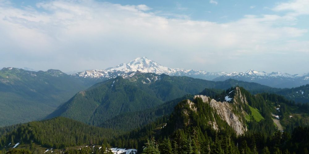
Circle Peak Trail #638.1
There are two routes to Circle Peak
A Forest Service Trailhead is located at the barricaded Meadow Mountain Forest Road, FSR #2710. At 1.5 miles you will come to a junction with Meadow Mountain trail #657 straight ahead and Crystal Lake trail #638 to the left. Take the left trail which continues up another deteriorating and neglected forest road that can be quite brushy. At 2 miles you will come to the end of the old road where the trail begins a steep ascent up an aged firebreak.
Although this is a very steep uphill scramble take time to relax and view Crystal Creek Falls as it drops about 40 feet down a rock embankment. After about .5 miles the firebreak levels off and becomes a trail with mature forest as it enters the Glacier Peak Wilderness. Ironically once you reach the lake, you will come to the forest service built trail crossing the outlet, with large stepping stones. It continues traversing Scar Pass joining up with the Circle Peak Trail #638.1 2.5 miles. The trail then passes through meadows the constant steep switchbacks until one reaches majestic Circle Peak where once stood a fire lookout.
If entering from Circle Creek Road, Forest Road #2703, there is a user cutoff trail at the junction of the Circle Peak and the Crystal Lake Trails. To reach Crystal Lake head to the right over Skaar Pass. This is a Forest Service built trail, which has not been maintained for many years due to road inaccessibility. Thanks to the devotion of three volunteer road clearing groups, RRT, DARA and FFPU, this road was able to be reopened.
Starting our hike on the Circle Peak Trail at the cut off, the trail descends down to Circle Creek where there was a bridge, now in need of major repairs being this trail and road had been inaccessible for many years. You will need to ford the creek to continue your hike. The trail continues through old growth forest then opens up to a large meadow with impressive rock wall.
After leaving the meadow the trail begins its steep steady climb of switchbacks of about 2 miles to the old Circle Peak Lookout site. It’s a real workout but take your time and enjoy an amazing array of wildflowers and blueberries as vistas open up as the meadow drops below you.
When you reach the false summit you will soon crest over the switchbacks with views to the southeast with Indigo Lake below. There are a couple of very steep rugged way trails down to the lake. Enjoy these beautiful views, but as you hike they will become even more far reaching and you will just find yourself standing there taking it all in! The summit isn’t far now.
The trail continues winding up towards the old lookout site and summit of Circle Peak at an elevation of 5,983 feet. The lookout started back in 1929 as a Rag House, a tent and camp, then in 1933 a lookout cab was built perched atop this mountain. Standing at the summit, it is easy to see why this site was chosen for a lookout looking out miles in all directions. Wonderful views of Meadow Mountain, Mt. Pugh, Sloan Peak, White Chuck Mountain and Glacier Peak looming in the background like the giant that it is.
Views from Crystal Lake Trail
Getting there:
Suiattle Route – From the Darrington Ranger Station, drive SR 530 north for 7 miles to the Suiattle River Road, FSR #26, drive for about 10 miles to the Boundary bridge on the right, this is Forest Road #25, drive 3.5 miles to Rat Trap Pass Road, FSR #27 and drive 7 miles to the Meadow Mountain – Crystal Lake Trailhead.
- To take the Circle Creek Road to the cutoff on the trails, drive 3.2 miles on Rat Trap Pass Road, turn left on Circle Creek Road, FSR #2703, drive about 7 miles to the end of the road where there is a log landing to park. The trail cut off is right before the log landing uphill.
Mountain Loop Highway Route – From the Darrington Ranger Station, take Mt. Loop Highway for 9 miles south to White Chuck Road, FSR #23 and turn left. Follow this road for 6 miles to Rat Trap Pass Road, FSR #27, turn left and drive 2.4 miles to the Meadow Mountain – Crystal Lake Trailhead on your right.
History:
This trail is the route to the old Circle Peak Lookout site.
Type of trail: USFS
Length: 5 miles one way or about 3 miles from Circle Creek Road
Elevation: 2,500 – 4,500 from trailhead or from cutoff 3,800 – 4,500
Level of difficulty: more difficult
Best seasons: Summer & Fall
Wilderness restrictions: Yes, enters Glacier Peak Wilderness
Northwest Trail Pass required
Restroom: No
Further Information:
